
Northern Mariana Islands

Commonwealth of the Northern Mariana Islands
For an up-to-date summary of the climate trends and future projections, and how climate change is affecting CNMI’s key sectors, see Climate Change in the Commonwealth of the Northern Mariana Islands: Indicators and Considerations for Key Sectors (January 2021). Authors from the CNMI Office of Planning and Development, the National Oceanic and Atmospheric Administration’s Office for Coastal Management, and the East-West Center—along with 50 technical contributors from local governments, NGOs, researchers, and community groups—collaboratively developed the CNMI PIRCA report. Climate Change in the Commonwealth of the Northern Mariana Islands is one in a series of new PIRCA reports aimed at assessing the state of knowledge about climate change indicators, impacts, and adaptive capacity of the US-Affiliated Pacific Islands and the Hawaiian archipelago.
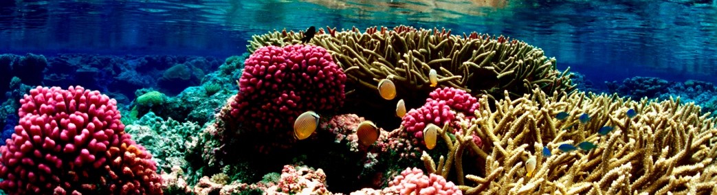
Large-scale tourism drives the Commonwealth of the Northern Mariana Islands (CNMI) economy, and many tourists visit to see the natural beauty of the Northern Mariana Islands, which is highly dependent on climate. Small increases in temperatures could result in large impacts to coral reefs, and subsequent impacts to the marine and coastal environment. Landfills to support the increasing population on the island have resulted in groundwater contamination on Saipan, which could contribute to disease [4], and have conflicted with environmental conservation and endangered species protection [1]. There is recognition that environmental degradation and stressors will exacerbate the impacts from variations and changes in climate. CMNI is located in the infamous Typhoon Alley, directly north of Guam. This puts the territory at risk on a routine basis for very powerful storms [6]. On December 8 and 9, 2002, Rota, the southernmost island of the CNMI was hit by Supertyphoon Pongsona. The typhoon produced sustained winds of 78 mph (126 km/h) with gusts up to 85 mph (137 km/h). The combination of winds and other effects from the typhoon left about 200 families homeless. The typhoon produced a storm surge of 22 ft (6.7 m) at Songsong Village, the largest village on the island. The surge caused moderate beach erosion on the island, and destroyed a fuel pier and a loading pipeline. Additionally, the typhoon caused severe crop damage on the island. The typhoon resulted in over $30 million in damage (2002 USD) [2].

Geography
The Northern Mariana Islands, together with Guam to the south, make up the Mariana Archipelago. The Northern Mariana Islands consist of fourteen islands in a chain running roughly north-south, spanning approximately 375 miles (604 km) [5]. The total land area is approximately 179 square miles (464 sq km). The southern islands are limestone with level terraces and fringing coral reefs, while the northern islands are volcanic [1]. The northern islands are all either uninhabited or only very lightly populated [5], and there are active volcanoes on three of the islands: Anatahan, Paga, and Agrihan. Anatahan Volcano started erupting very suddenly in 2003, and has continued to alternate between eruptive and calm periods ever since [4]. The three southern islands – Saipan, Tinian, and Rota – are the largest and most populated in the chain. These three islands account for 65% of CNMI’s land area, 99% of the population and almost all of the economic activity and energy use. The island of Saipan is the capital and government seat, the major business center, and the largest and most populated island [6], with more than 90% of the country’s population [4]. The Mariana Trench, located to the east of the Northern Mariana Islands, is the deepest point in the world’s oceans. The measurement from the floor of the Mariana Trench to the top of Mount Tapotchau on Saipan, the highest point in the CNMI, is 37,752 feet (in comparison, from sea level Mount Everest measures 29,028 feet) [5].
Climate
The Northern Mariana Islands are considered the sunniest islands in Micronesia [3], and the Guiness Book of World Records has listed Saipan as having the most equable climate in the world [4]. The islands have a tropical marine climate moderated by seasonal northeast trade winds from November to March and easterly winds from May to October. Average year-round temperature is 84° F (28.9 °C) with an average humidity of 79%. There is little seasonal temperature variation. Temperature, however, is affected by elevation; hence, the islands of Saipan and Rota show considerable temperature variations between the coastal and mountainous areas [5]. The dry season runs from December to June, and the rainy season from July to November [4]. Sometimes the islands experience droughts from low rainfall during the dry season [5], and have also experienced drought during strong ENSO events, although not as severely as many other islands in Micronesia. The CNMI is situated some 600 miles (966 km) east of an area in the western Pacific which is the breeding area of cyclonic disturbances. As a result the CNMI is in what is known as weather condition four at all times, which means that 40 mile (64 km) an hour winds are possible within 72 hours [5]. These cyclonic disturbances can quickly and sometimes unexpectedly develop into typhoon force winds of up to 120 miles (193 km) per hour or greater. Typhoon season runs from July to January, and the islands of the CNMI are usually subject to at least one typhoon each year [5]. Flooding and wind-damaged vegetation are a common result of frequent storms with winds above 60 mph (97 kph) [6].

Demographics
The estimated population of the CNMI is 51,659 (July 2021 est.) [1]. In 2000, the population was 69,211, which means the population has decreased by approximately 25% over the past two decades. This significant decrease is due to a number of factors, including the end of the garment industry (the vast majority of whose employees were female from China), economic crises, and a decline in tourism, which is one of the CNMI’s primary sources of revenue [4]. Because of volcanic threat, the northern islands have been largely uninhabited. Saipan, Tinian, and Rota in the south are the only permanently populated islands. More than 90% of the population lives on Saipan, the capital and largest island [4]. The main ethnicities in the CNMI are Asian 50% (includes Filipino 35.3%, Chinese 6.8%, Korean 4.2%, and other Asian 3.7%), Native Hawaiian or other Pacific Islander 34.9% (includes Chamorro 23.9%, Carolinian 4.6%, and other Native Hawaiian or Pacific Islander 6.4%), other 2.5%, two or more ethnicities or races 12.7% (2010 est.) [1]. English, Chamorro, and Carolinian are all official languages [4]. The main languages spoken are Philippine languages 24.4%, Chinese 23.4%, Chamorro 22.4%, English 10.8%, other Pacific Island languages 9.5%, and other 9.6% (2000 census) [1]. Due to centuries of Spanish colonization of the Mariana archipelago, the majority of the population is Roman Catholic, although traditional beliefs and practices can still be found [1].
History
The Mariana archipelago was initially settled by Chamorro migrants from Southeast Asia around 2000 BC. All the inhabited islands of the archipelago share an ancient history and culture; however, they are now politically separated into the Commonwealth of the Northern Mariana Islands, and the Territory of Guam. Pre-contact Chamorro society was stratified into three classes, called matua (upper class), achaot (middle class), and mana’chang (lower class). Belief in the spirits of ancestors was the foundation of the indigenous religion, and inter-island transportation took place in sailing canoes, called “flying proas” by early European explorers because of their speed. Thatched houses were built on top of huge carved stone and coral pillars known as “latte stones”, some of which still exist and are unique throughout the Pacific. The archipelago was formally colonized by Spain in 1668, and remained part of the Spanish colonial empire until the Spanish-American War. Practically all aspects of Chamorro culture – from language to food to religious beliefs – were impacted by more than two centuries of Spanish colonialism [7]. In addition to the decimation of the Chamorro people by foreign diseases, Spanish colonists relocated the Northern Mariana Islanders to Guam to facilitate cultural assimilation and conversion to Christianity. New settlers from the Philippines and the Caroline Islands were brought in to repopulate the islands. The Chamorro population was eventually allowed to return, and today both Chamorros and Carolinians are considered indigenous to the islands. After more than two centuries of Spanish colonization, the Northern Mariana Islands were sold to Germany 1899 (minus Guam, which was ceded to the U.S.). In 1919 the League of Nations awarded Japan the Northern Mariana Islands as part of the South Pacific Mandate. Japan colonized and developed the islands until World War II, when the U.S. military invaded in 1944. The American plane Enola Gay, which dropped the atomic bomb on Hiroshima, took off from Tinian in the Northern Mariana Islands. After Japan’s defeat, the islands were administered by the United States as part of the United Nations Trust Territory of the Pacific Islands. The people of the Northern Mariana Islands decided in the 1970s not to seek independence, but instead to forge closer links with the U.S. A covenant to establish a commonwealth in political union with the U.S. came into force in 1976. A new government and constitution went into effect in 1978. Similar to other U.S. territories, the islands do not have representation in the U.S. Senate, but are represented in the U.S. House of Representatives by a non-voting delegate [4]. Indigenous inhabitants are U.S. citizens but do not vote in presidential elections [1].

Natural Resources and Economy
The Commonwealth of the Northern Mariana Islands benefits from substantial subsidies and development assistance from the federal government of the United States. U.S. air and naval military stations add to the resident population and the local economy. The economy also relies heavily on tourism, which has recovered over the past few years, as Chinese and Korean tourists have replaced Japanese tourists [1]. One-fifth of the land is the CNMI is arable [4], and the local population practices subsistence farming and fishing, although a number of crops are produced commercially, such as taro, cassava, yams, breadfruit and bananas [1, 6]. The garment industry was formerly a huge driver of the CNMI economy (and contributed approximately 20,000 people to the national population), however due to a number of factors the industry is now essentially dead. The CNMI had successfully used its position as a free trade area with the U.S., while at the same time not being subject to the same labor laws, such as minimum wage, to allow garments produced in the CNMI to be labeled “Made in USA” without having to comply with all U.S. labor laws. However, the U.S. minimum wage law signed by President Bush on May 25, 2007 (amended by President Obama in 2009) resulted in stepped increases in the CNMI’s minimum wage. In 2018 the minimum wage finally reached $7.25, matching the U.S. federal minimum wage [4]. In addition, an immigration system mostly outside of federal U.S. control (which ended on November 28, 2009) resulted in a large number of Chinese migrant workers employed in the islands’ garment trade. However, the lifting of World Trade Organization restrictions on Chinese imports to the U.S. in 2005 put the CNMI-based trade under severe pressure, leading to a number of factory closures. After the addition of the U.S.-imposed scheduled wage increases, the garment industry became extinct by 2009 [4].
Related Links
National Weather Service Forecast Office Tiyan, Guam Latest Seasonal Sea Level Forecast for CNMI Latest Seasonal Rainfall Forecast for CNMI Rainfall variations during ENSO References [1] Central Intelligence Agency’s The World Factbook, https://www.cia.gov/the-world-factbook/countries/northern-mariana-islands/, accessed April 14, 2021. [2] NOAA/NWS Meteorological Assessment for Typhoon Pongsona in: Pohnpei State, FSM; Chuuk State, FSM; Guam; and, Rota, CNMI. 2003. http://www.nws.noaa.gov/os/data/pdfs/Pongsona_assessment_Final.pdf, accessed May 5, 2021. [3] Shea, E., G. Dolcemascolo, C.L. Anderson, A. Barnston, C.P. Guard, M.P. Hamnett, S.T. Kubota, N. Lewis J. Loschnigg, & G. Meehl. 2001. Preparing for a Changing Climate: The Consequences of Climate Variability and Change for Pacific Islands. Honolulu: East-West Center, http://www.eastwestcenter.org/publications/preparing-changing-climate-potential-consequences-climate-variability-and-change-execut, accessed April 14, 2021. [4] Wikipedia, http://en.wikipedia.org/wiki/Northern_Mariana_Islands, accessed May 5, 2021. [5] The CMNI Guide, https://www.cnmi-guide.com/infos/, accessed April 14, 2021. [6] U.S. Department of Interior. 2006. United States of American Insular Energy Assessment Report 2006. Suva, Fiji: Pacific Power Association, www.doi.gov/oia/reports/upload/U-S-Insular-Area-Energy-Assessment-Report-2006.pdf, accessed May 5, 2021. [7] Wikipedia, http://en.wikipedia.org/wiki/Guam, accessed April 14, 2021.
your website is good and has really good explanation of things and helped alot for my school project