
Marshall Islands

Republic of the Marshall Islands
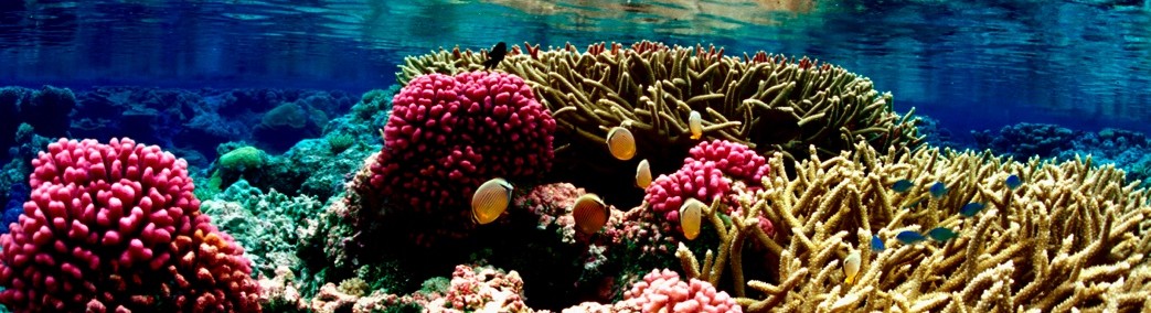
The Republic of the Marshall Islands (RMI) is historically referred to in folklore as “jolet jen Anij” (gifts from God). A God-given sanctuary apart from the harshness of other areas is therefore part of the socio-cultural identity of the people. However, they are now often referred to as a “front line state” with regard to the climate change issue. Moreover, the Marshall Islands lie in open ocean, and the average height above sea level of its 1,225 islets in 29 atolls is only 7 feet (2 meters). Fragile coral reefs fringe the atolls, and serve as the only line of defense against the ocean surge. The clearance over the reef in the sections that are covered by water is usually no more than a couple of feet. Given the physics of wave formation and the increasing frequency and severity of storms, the Marshall Islands will likely be at even greater risk in the future. It is likely that evacuation would have to be effected long before inundation is total. The Marshallese would become among the first of many environmental refugees [1]

Geography
The Marshall Islands is composed of 29 coral atolls and 5 single coral islands, which form two roughly parallel chains running northwest to southeast: the eastern Ratak (Sunrise) chain and the western Rālik (Sunset) chain. The island nation encompasses over 750,000 sq miles (1,942,491 sq km) of ocean, but includes only about 70 sq miles (181 sq km) of land mass [2]. The islands are located about halfway between Hawaiʻi and Australia [3], in the region of the Pacific known as Micronesia. The capital of the Marshall Islands is Majuro, located in the Ratak Chain. Kwajalein lagoon is the largest in the world, covering 840 sq miles (2,176 sq km) [4]. Kwajalein is also a World War II battleground, and is currently used as a US missile test range. The atolls of Bikini and Enewetak are former US nuclear test sites [5].
Climate
The weather in the Marshall Islands is tropical – hot and humid, but tempered by trade-winds which prevail throughout the year. The trades are frequently interrupted during the summer months by the movement of the Intertropical Convergence Zone (ITCZ) across the area [6]. The recorded annual temperature averages since 1948 show hardly any fluctuation with 82.6 °F (28.1 °C) at Kwajalein Weather Station in 2007 [7]. Due to the long distance from north to south, rainfall varies greatly throughout the Marshall Islands. In the wet, southern atolls, rainfall is heavy and can average as much as 160 inches (1,524 mm) per year, while the dry, northern atolls may only average 20 inches (508 mm). There is also a wet and dry season, with the wettest months being between May and November [1]. Pacific typhoons generally develop to the east of the Marshall Islands area, but the RMI is only occasionally subjected to the full brunt of a Pacific typhoon. The northern atolls are more subject to typhoons than are the southern atolls. The storms (sustained winds of 40-74 mph/64-119 km/h) impact the atoll about once every four to seven years on average, corresponding with El Niño-Southern Oscillation (ENSO) events that warm the ocean waters and provide conditions for the genesis of cyclones [8]. Much more common are minor storms of the easterly wave type, especially from March to April and October to November [1].

Demographics
The estimated population of the Marshall Islands is 68,480 (July 2011). Over two-thirds of the total population lives in Majuro, the capital, and Ebeye, the secondary urban center, located in Kwajalein Atoll [2]. Ebeye is one of the most densely populated locations in the world. The main ethnicities are Marshallese 92.1%, mixed Marshallese 5.9%, and other 2% (2006 estimate). Marshallese and English are both official languages, with Marshallese being spoken by approximately 98% of the population, and English widely spoken as a second language. The main religions are Protestant 54.8%, Assembly of God 25.8%, Roman Catholic 8.4%, Bukot ñan Jesus 2.8%, Mormon 2.1%, other Christian 3.6%, other 1%, and none 1.5% (1999 census) [3]. Increasing numbers of Marshallese are migrating to the United States in search of education and employment, with the largest population centers in Hawaiʻi and Arkansas.
History and Government
The Marshallese people and language are of Micronesian origin, which is traced back to successive waves of immigrants from Southeast Asia approximately 2,000-3,000 years ago. These travelers spread throughout the Western Pacific, settling the islands as they went. Marshallese culture is matrilineal, and revolves around a complex system of clans and lineages tied to land ownership [2]. First European contact occurred in the 1520s, when a number of Spanish explorers visited the islands. English explorer John Marshall, for whom the islands are now named, sailed through in 1799 [5]. The Marshall Islands were claimed as a territory by Spain in 1874, and then became a German protectorate in 1885. Japan took control of the islands at the beginning of World War I, and the Marshall Islands was the site of many bloody World War II battles. At the end of World War II, the Marshall Islands became part of the Trust Territory of the Pacific Islands (TTPI), a United Nations trust territory administered by the US [2]. In the decade after World War II, the US conducted over 60 nuclear tests on the atolls of Bikini and Enewetak, including the infamous “Bravo” shot which irradiated multiple neighboring atolls, leaving a legacy of health issues and nuclear-related claims which continue to this day. The Government of the Marshall Islands was officially established and the country became self-governing in 1979. The Compact of Free Association between the US and the Marshall Islands was signed in 1986, which allows for aid and immigration rights in exchange for US strategic denial in the islands [5]. The second Compact was signed in 2003, and continues until 2023. The modern government is a parliamentary democracy in free association with the US [2].
Natural Resources and Economy
US government assistance is the main driver of the Marshall Islands economy. The GDP was $133.5 million in 2008. Under the terms of the Amended Compact of Free Association, the US will provide millions of dollars per year to the Marshall Islands (RMI) through 2023, at which time a Trust Fund made up of US and RMI contributions will begin perpetual annual payouts. Agricultural production, primarily subsistence, is concentrated on small farms; the most important commercial crops are coconuts and breadfruit [3]. Small-scale industry is limited to handicrafts, tuna processing, and copra, which is subsidized by the government. The tourist industry, currently employing less than 10% of the labor force, remains the best hope for future added income. As one of only four coral atoll nations in the world, as well as one of the world’s premier fishing and diving locations, there is a potential for increased foreign tourism [1]. The islands have few natural resources – primarily tuna fisheries, phosphate deposits, and deep seabed materials. Imports far exceed exports [2,3].
Drought for atolls is an extremely serious issue, one that effects human health and well-being as well as commerce, agriculture, and many other sectors. Due to an ENSO-related drought following Typhoon Paka in 1998, only eight percent of normal rain fell in the Marshall Islands over the period from January to March, causing the government to declare the country a disaster area [9]. In addition to the negative impacts on human health and the provision of services, the drought also caused severe impacts on agriculture. Aelōñlaplap Atoll lost 55% of their coconuts, 85% of their breadfruit, and 99% of their bananas [10]. The Marshall Islands’ Tobolar Copra Company reported that once the drought ends, it takes nine to twelve months for coconuts to begin producing at full strength again. Because of the cargo space required for the feeding assistance program, the ships did not retrieve the copra that had already been produced, resulting in large financial losses for the copra industry [11]. Fresh water resources on atolls are limited and fragile, and significant planning will be necessary to ensure the continued availability of this resource under future climate conditions.
Related Links Climate Information for Kwajalein from RTS Kwajalein (updated daily) National Weather Service Majuro Weather Service Office (WSO) Latest Seasonal Sea Level Forecast for RMI Latest Seasonal Rainfall Forecast for RMI Rainfall Variation during ENSO ENSO and Sea Level Variability: A Historical Perspective (Guam, Marshalls and American Samoa SPECIAL SECTION: ENSO and Sea-Level Variability (2): Physical Mechanism (Guam, Marshalls, and American Samoa) Rainfall Composite Maps for Seasons during El Niño/La Niña References [1] Embassy of the Republic of the Marshall Islands, http://www.rmiembassyus.org/, accessed July 24, 2018. [2] US Department of State, http://www.state.gov/r/pa/ei/bgn/26551.htm, accessed July 5, 2012. [3] Central Intelligence Agency, The World Factbook https://www.cia.gov/library/publications/the-world-factbook/geos/rm.html, accessed July 5, 2012. [4] U.S. Department of Interior. 2006. United States of American Insular Areas Energy Assessment Report 2006. Suva, Fiji: Pacific Power Association. www.doi.gov/oia/reports/upload/U-S-Insular-Area-Energy-Assessment-Report-2006.pdf, accessed July 6, 2012. [5] “Marshall Islands.” Wikipedia, http://en.wikipedia.org/wiki/Marshall_Islands#Nuclear_tests_after_World_War_II, accessed July 6, 2012. [6] Shea, E., G. Dolcemascolo, C.L. Anderson, A. Barnston, C.P. Guard, M.P. Hamnett, S.T. Kubota, N. Lewis J. Loschnigg, & G. Meehl. 2001. Preparing for a Changing Climate: The Consequences of Climate Variability and Change for Pacific Islands. Honolulu: East-West Center, http://www.eastwestcenter.org/publications/preparing-changing-climate-potential-consequences-climate-variability-and-change-execut, accessed July 6, 2012. [7] National Climatic Data Center (NCDC), National Oceanic and Atmospheric Administration. [8] Spennemann, D.H.R. and I. C. Marschner. 1994. Stormy years: on the association between the El Niño/Southern Oscillation phenomenon and the occurrence of typhoons in the Marshall Islands. Report to the Federal Emergency Management Agency. Region IX, San Francisco. Johnstone Centre of Parks, Recreation and Heritage, Report No. 9. The Johnstone Centre of Parks, Recreation and Heritage, Charles Sturt University, Albury, NSW. [9] Falkland, Tony, Marc Overmars and David Scott. 2002. Pacific Dialogue on Water and Climate. Suva: SOPAC. [10] Marshall Islands Ministry of Resources and Development, Agriculture Division. 1998. “Agriculture Survey for Paka: Ailinlaplap Atoll”. [11] Marshall Islands Journal (MIJ). 1998. “US Officials Surprised by Angry RMI Rebuke.” The Marshall Islands Journal. Friday, March 20, 1998, 29(12).
Hi, i’m creating a school project about the island countries in Micronesia, and your article about the Marshal islands was really good info! Thanks 🙂
Bon post. j’apprécie énormément votre site internet