
Territory of Guam

Territory of Guam
For an up-to-date summary of the climate trends and future projections, and how climate change is affecting Guam’s key sectors, see Climate Change in Guam: Indicators and Considerations for Key Sectors (November 2020). Authors from the University of Guam and the East-West Center—along with more than 30 technical contributors from local governments, NGOs, researchers, and community groups—collaboratively developed the Guam PIRCA report. Climate Change in Guam is one in a series of new PIRCA reports aimed at assessing the state of knowledge about climate change indicators, impacts, and adaptive capacity of the US-Affiliated Pacific Islands and the Hawaiian archipelago.
Geographically part of the Mariana Archipelago, Guam shares an ancient history and culture with the other islands in the chain. The archipelago was settled approximately 4,000 years ago by the Chamorro people, who maintained a culture and language that is unique throughout the Pacific. Guam and the Mariana Islands were among the first islands sited by European explorers, by Spanish explorer Ferdinand Magellan in 1521. The island chain has been colonized ever since, by a succession of colonial powers, including Spain for over two hundred years. However, Guam’s political and colonial history diverged from the rest of the Mariana Islands in 1898 after the Spanish-American War, when Spain ceded Guam to the United States, and sold the remainder of the Mariana Islands to Germany. After experiencing major battles and extreme violence under Japanese occupation during World War II, Guam officially became a U.S. territory in 1950. Under the Guam Organic Act, Guamanians are represented in Congress by a nonvoting member, and are U.S. citizens but cannot vote. Guam has become the commercial and population hub of the Micronesian region, and is by far the most developed island in the area. Because it is a high island, Guam has extensive freshwater resources, and is not threatened by sea-level rise like the low atoll nations in the region. However, Guam lies directly within the typhoon belt, and is regularly hit by major storms and typhoons [9]. On December 8, 2002, Supertyphoon Pongsona produced strong wind gusts peaking at 278 km/h (173 mph), which left the entire island of Guam without power and destroyed about 1,300 houses. Damage on the island totaled over $700 million (2002 USD, $800 million 2007 USD) and was considered by the Federal Emergency Management Agency (FEMA) to be the costliest United States disaster in 2002 in a single state or territory [3, 7].

Geography
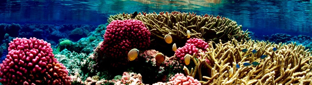
The island of Guam is the largest and southernmost island in the Marianas archipelago, which continues northward from Guam and makes up the Commonwealth of the Northern Mariana Islands. At 212 sq miles (549 sq km), it is the largest island in Micronesia. The capital, Hagåtña (formerly Agana), is located on the west coast, near the middle of the island, and is the seat of government and the site of the main commercial districts on Guam [10]. The northern part of the island is a forested coralline limestone plateau with sheer coastal cliffs, while the south contains volcanic peaks covered in forest and grassland. A coral reef surrounds most of the island, except in areas where bays exist that provide access to small rivers and streams that run down from the hills into the Pacific Ocean and Philippine Sea [1, 9]. The Northern Guam Lens provides nearly 40 million gallons per day of drinking water (about 80 percent of the total) to the island of Guam [8]. Guam is the closest landmass to the Mariana Trench, the deepest point in the ocean [9]. Because of its strategic location in the western North Pacific Ocean, the U.S. has long maintained military bases there [1].
Climate
Guam’s climate is almost uniformly warm and humid throughout the year. Generally, the temperature range is from the low 70s to the middle 80s Fahrenheit. The coolest and least humid months, marked by prevailing westerly tradewinds, are in December through February. Although the warmest months are from March through August, the tradewinds still blow steadily from the east or northeast. There are two seasons, the dry and the rainy. The dry season typically begins in December and extends through June. The rainy season falls within the remaining months [4]. The annual rainfall totals 80-110 inches (2,032-2,794 mm) [4]. Three-quarters of the rain falls between during the rainy season between June and December [6]. During the rainy season there is a breakdown of the trades, and on some days the weather may be dominated by westerly-moving storm systems that bring heavy showers, or steady and sometimes torrential rain [5]. Guam lies within the typhoon belt and is periodically struck by tropical storms and typhoons [6], which are most frequent from June through December. An average of three tropical storms and one typhoon pass within 180 nautical miles (330 km) of Guam each year. Since 1962, ten of thirteen major disaster declarations resulted from typhoons, and two of the other disasters were associated with climate [2]. The most intense typhoon to pass over Guam recently was Super Typhoon Pongsona on December 8, 2002, with sustained winds of 125 miles per hour, leaving massive destruction as the oil tanks in Apra Harbor caught fire [1, 2]. The loss of harbor operations made response to the disaster more difficult [2].
Demographics

The estimated population of Guam is 168,801 (July 2021 est.) [1]. Residents of Guam are known as Guamanians, and the indigenous inhabitants are called Chamorro. Over two-thirds of the population lives in the capital, and more than 90% of the population is urban. Although population growth has been relatively slow over the past decade, the possible military buildup on the island could cause unprecedented population grown in the coming years, with tens of thousands of military personnel, their dependents, and others possibly moving to Guam [9]. The main ethnicities on the island are Chamorro 37.3%, Filipino 26.3%, White 7.1%, Chuukese 7%, Korean 2.2%, other Pacific Islander 2%, other Asian 2%, Chinese 1.6%, Palauan 1.6%, Japanese 1.5%, Pohnpeian 1.4%, mixed 9.4%, other 0.6% (2010 est.) [1]. Both English and Chamorro are official languages of Guam [9], with English spoken by 43.6%, Filipino 21.2%, Chamorro 17.8%, other Pacific island languages 10%, Asian languages 6.3%, other 1.1% (2010 est.). Due to historic Spanish colonization of Guam, approximately 85% of the population is Roman Catholic [1].
History and Government
The Mariana archipelago was initially settled by Chamorro migrants from Southeast Asia, most likely Indonesia, around 2000 BC. All the inhabited islands of the archipelago share an ancient history and culture; however, they are now politically separated into the Commonwealth of the Northern Mariana Islands, and the Territory of Guam, which is comprised of only the southernmost and largest island in the chain. Pre-contact Chamorro society was stratified into three classes, called matua (upper class), achaot (middle class), and mana’chang (lower class). Belief in the spirits of ancestors was the foundation of the indigenous religion, and inter-island transportation took place in sailing canoes, called “flying proas” by early European explorers because of their speed. Thatched houses were built on top of huge carved stone and coral pillars known as “latte stones”, some of which still exist and are unique throughout the Pacific. Guam was one of the first islands in the Pacific discovered by Europeans, in 1521 by Spanish explorer Ferdinand Magellan. The island was formally colonized by Spain in 1668, and remained part of the Spanish colonial empire until it was surrendered to the U.S. in 1898 during the Spanish-American War. Practically all aspects of Chamorro culture – from language to food to religious beliefs – were impacted by more than two centuries of Spanish colonialism. After 1898, Guam was the only U.S.-held territory in the Pacific before World War II, but in 1941 Japan captured the island almost immediately after the bombing of Pearl Harbor. The U.S. did not recapture the island until 1944, until which time the occupying Japanese subjected the local inhabitants to torture, concentration camps, forced enculturation, and other war crimes; the memory and legacy of this violence still continues to this day. After the war, the Guam Organic Act of 1950 established Guam as an unincorporated organized territory of the United States, provided for the structure of the island’s civilian government, and granted the people U.S. citizenship. Since Guam is not a U.S. state, citizens residing on Guam are not allowed to vote for president and their congressional representative is a non-voting member of Congress [9]. Today the U.S. military installation on Guam is one of the most important bases in the Pacific [1], and is poised expand even more with the possible relocation of tens of thousands of military personnel, their spouses and dependents, and other staff from Okinawa in the near future [9].
Natural Resources and Economy
The Guam economy depends primarily on tourism, U.S. Department of Defense installations, and locally owned businesses. The tourist hub, called Tumon, features many shopping, entertainment, and vacation venues and is a popular destination for tourists from South Korea, the U.S., the Philippines, Taiwan, and especially Japan [9]. Guam receives no foreign aid, but as a U.S. territory it does receive federal funding from the U.S. treasury. As a U.S. territory, Guam is also open to immigration from the Freely Associated States, which include Palau, the Marshall Islands, and the Federated States of Micronesia (FSM). Citizens of the FSM especially are increasingly migrating to Guam because of its proximity as well as environmental and cultural familiarity. Although these migrants do contribute to the workforce and the economy, they also increase the resources required by public assistance programs and the public education system [9]. Guam has experienced problems with invasive, introduced plant and animal species causing ecological damage for at least a century. Especially prevalent are the cane toad, the giant African snail, the coconut rhinoceros beetle, and the brown tree snake, which was introduced during World War II and has nearly eradicated the native bird population [9]. As a higher island, Guam has plentiful freshwater resources, which means that there are fewer problems with water supply during ENSO events and typhoons and other natural disasters. The coral reefs, which provide habitat, food, and protection for the islands, as well as attraction for the tourism industry, can experience increased pressure from extreme weather events that result in bleaching or sedimentation that covers and kills the reefs. During disasters throughout Micronesia, people from atoll islands historically migrate to Guam because it usually has more food and water resources available. With increased future migration from the impacts of climate change, Guam’s resource needs may exceed its carrying capacity.

Related Links National Weather Service Weather Forecast Office Guam Latest Seasonal Sea Level Forecast for Guam Latest Seasonal Rainfall Forecast for Guam Rainfall Variations during ENSO Tropical Pacific Islands Rainfall Outlooks from NOAA’s Climate Prediction Center (CPC) References [1] Central Intelligence Agency, The World Factbook, https://www.cia.gov/the-world-factbook/countries/guam/#people-and-society, accessed May 13, 2021. [2] Federal Emergency Management Agency, http://www.fema.gov/femaNews/disasterSearch.do, accessed August 30, 2012. [3] Federal Emergency Management Agency. 2003. Super Typhoon Pongsona: The First 100 Days Over $300 Million In Disaster Relief And Assistance, http://www2.fema.gov/news/newsrelease.fema?id=2240, accessed August 30, 2012. [4] National Weather Service Forecast Office, Tiyan, Guam, https://www.weather.gov/gum/, accessed August 30, 2012. [5] Shea, E., G. Dolcemascolo, C.L. Anderson, A. Barnston, C.P. Guard, M.P. Hamnett, S.T. Kubota, N. Lewis J. Loschnigg, & G. Meehl. 2001. Preparing for a Changing Climate: The Consequences of Climate Variability and Change for Pacific Islands. Honolulu: East-West Center, http://www.eastwestcenter.org/publications/preparing-changing-climate-potential-consequences-climate-variability-and-change-execut, accessed May 13, 2021. [6] U.S. Department of Interior. 2006. United States of American Insular Energy Assessment Report 2006. Suva, Fiji: Pacific Power Association, https://www.doi.gov/sites/doi.gov/files/migrated/oia/reports/upload/U-S-Insular-Area-Energy-Assessment-Report-2006.pdf, accessed May 13, 2021. [7] Wikipedia, Typhoon Pongsona, http://en.wikipedia.org/wiki/Super_Typhoon_Pongsona#cite_note-femlast-0, accessed May 13, 2021. [8] USGS Pacific Islands Water Science Center, http://hi.water.usgs.gov/studies/guamlens/index.html, accessed August 30, 2012. [9] Wikipedia, http://en.wikipedia.org/wiki/Guam, accessed August 27, 2012. [10] Wikipedia, http://en.wikipedia.org/wiki/Hag%C3%A5t%C3%B1a,_Guam, accessed August 29, 2012.

Pingback: Guam and Climate Change | Eslkevin's Blog