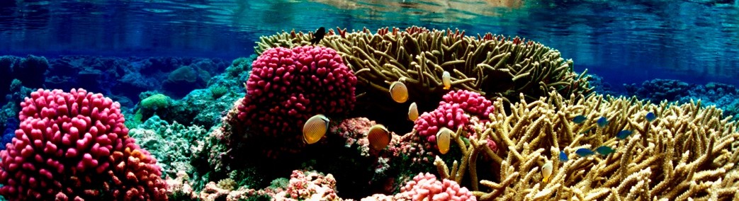
American Sāmoa has several climate-sensitive sectors that provide livelihood for local communities, including the tuna industry that is the primary economic driver, as well as marine and coastal ecosystems. ENSO has demonstrated impacts on the migration and abundance of tuna in the tropical Pacific Ocean [4]. The changes in catch sizes, species composition, and other characteristics pose challenges to harvesting and processing, which can result in economic losses [3]. To cope with and adapt to these changes, there is a clear need to integrate climate information and study into fisheries research and management. American Sāmoa developed a climate change working group within the Coral Reef Advisory Group to monitor impacts of changes on coral reef ecosystems. Understanding that the natural environment contributes to their livelihood, the American Sāmoa government has formed many environmental task forces and initiatives to promote sustainable development of resources for the long-term survival of their people.
Geography
American Sāmoa is part of the Samoan Islands archipelago, located in the mid-South Pacific Ocean in the heart of the region known as Polynesia. The main island, Tutuila, is the location of the capital of Pago Pago and the majority of the nation’s population. There are four other inhabited volcanic islands: Aunu’u, which is close to Tutuila; and Ofu, Olosega, and Ta’u, which are located approximately 70 miles (110 km) east of Tutuila and together make up the Manu’a Islands [12]. Two coral atolls – uninhabited Rose Atoll, which is part of a marine national monument, and inhabited Swains Atoll – are also included in the territory. The total land area of the nation is 77 sq miles (199 sq km) [8]. The volcanic islands are extremely rugged, with limited coastal plains, and only about thirty percent of the land is available for development [9]. Pago Pago harbor, located on Tutuila Island, is one of the best natural deepwater harbors in the South Pacific. Its excellent shipping capacity, as well as strategic location in the South Pacific Ocean, led to significant international interest in and presence on the island since the 19th century, resulting in the U.S. formally occupying the islands in 1900 [7, 8].
View of Pago Pago Harbor entrance from the nearby ridgeline at the Falepule Hotel and Restaurant. (Source: Cheryl Anderson, 2005)
Climate
American Sāmoa’s climate is tropical with a relatively dry season, June through August, and a wet season, January through March. The amount of rainfall can vary greatly depending on the location and from year to year [6]. For example, the rainfall averages about 125 inches a year at the airport, but Pago Pago, less than 4 miles from the airport at the head of a harbor open to the prevailing wind, receives nearly 200 inches a year [5]. Trade winds blow almost continually [6]. The prevailing winds throughout the year are easterly trades, interrupted more often in summer than winter, and sometimes associated with tropical cyclones, convergence bands, and upper-level disturbances. Heavy showers and long rainy periods can occur in any month, while typhoons are common from December to March [13]. Tropical cyclones impact the island chain with tropical storm-force winds on average once every three years [7]. In 2003, heavy rainfalls resulted in severe landslides and flooding, for which a Presidential Disaster Declaration was made [1]. Tropical Cyclone Heta in 2004 and Tropical Cyclone Olaf in 2005 resulted in disaster declarations with flooding, high surf, and high winds [2].
Demographics
The estimated population of American Sāmoa is 46,366 (July 2021 est.) [8], with about 97% living on the main island of Tutuila [7]. The main ethnicities are native Pacific Islander 92.6%, Asian 3.6%, 3.9% are of other origins (2010 census) [8]. English and Samoan are both official languages [7], with 88.6% of the population speaking Samoan, 3.9% English only, 2.7% Tongan, and 4.1% other languages. However, most people are bilingual [8]. The main religions are Christian Congregationalist 50%, Roman Catholic 20%, Protestant and other 30% [8]. Like other Polynesian nations, out-migration is common, as people regularly move to Hawaii or the mainland U.S. in search of jobs, income, and education [9].
Gathering of Matai to celebrate Samoa Flag Day. (Source: American Samoa Coastal Management Program, 2003)
History and Government
American Sāmoa is both geographically, culturally, and linguistically linked to what is now the independent nation of Sāmoa, and together both nations make up the Samoan archipelago. The archipelago was initially inhabited around 1500 B.C., by settlers traveling from Southeast Asia through Melanesia. Early settlers were part of the Lapita eastward expansion, and maintained close ties with the neighboring islands of Fiji and Tonga, through travel as well as marriage. Samoan culture, or fa’asamoa, was the foundation of life in these islands, and remains an extremely important force to this day. Traditional life was communal, centered on the village and led by the chiefs, or matai. Certain traditional practices, such as the kava ceremony, traditional dancing or siva, and tattooing are still practiced, however the ancient religion has been almost totally replaced by Christianity, which today is an extremely important aspect of Samoan life [14]. Contact with European explorers began in the early 18th century, and by the early 19th century the London Missionary Society was conducting mission work in the islands. By the late 1800s, the U.S. and numerous Europeans nations had come to depend on Pago Pago Harbor as a refueling station, and international tension and eventually violence arose. Rivalries were settled in 1899 by the Tripartite Convention, which divided the Samoan Islands in half and awarded the western islands (now the independent nation of Sāmoa) to Germany, and the eastern islands (now American Sāmoa) to America [7, 8]. This initial division has greatly impacted the islands’ future directions, with American Sāmoa adopting more American-style culture and customs as well as emigrating to the U.S., and independent Sāmoa developing closer cultural and political ties to New Zealand and the British empire. Since the U.S. Congress has never passed an Organic Act for American Sāmoa, the territory is technically considered “unorganized”, however it is self-governing under the constitution of 1967. American Samoans are U.S. nationals, not citizens, and therefore cannot vote in U.S. presidential elections. American Sāmoa is represented by one non-voting delegate in Congress. In addition to American-style government, the traditional chiefly system, or fa’amatai, and the Council, or Fono, continue to play a large part in all aspects of Samoan life [7].
Natural Resources and Economy
Most of American Sāmoa’s economy is based directly or indirectly on U.S. federal expenditures and the tuna canning industry. The rest stems from a small tourism industry and small businesses such as retail and handicrafts [8, 11]. Employment is divided between the public sector, the tuna cannery, and the rest of the private sector [7]. Tuna fishing and the one remaining tuna processing plant are the mainstay of the private sector, with canned tuna the primary export [7, 8]. Because of the small size and steep terrain of the islands, there are limited natural resources, especially arable land and fresh water [9]. There is some agriculture, including small-scale subsistence agriculture [10], primarily growing tropical food crops such as bananas, coconuts, taro, breadfruit, pineapples, and papayas [8]. Attempts by the government to develop a larger and broader economy are restrained by Sāmoa’s remote location, limited transportation, and limited natural resources. In late September 2009, an earthquake and subsequent tsunami devastated American Sāmoa and nearby Sāmoa, disrupting transportation and power generation, and resulting in about 200 deaths. The US Federal Emergency Management Agency is overseeing a relief program of nearly $25 million [8].
Resilient and sustainable Pacific Island communities using climate information to manage risks and support practical decision-making about climate variability and change.

American Sāmoa
Territory of American Sāmoa
American Sāmoa has several climate-sensitive sectors that provide livelihood for local communities, including the tuna industry that is the primary economic driver, as well as marine and coastal ecosystems. ENSO has demonstrated impacts on the migration and abundance of tuna in the tropical Pacific Ocean [4]. The changes in catch sizes, species composition, and other characteristics pose challenges to harvesting and processing, which can result in economic losses [3]. To cope with and adapt to these changes, there is a clear need to integrate climate information and study into fisheries research and management. American Sāmoa developed a climate change working group within the Coral Reef Advisory Group to monitor impacts of changes on coral reef ecosystems. Understanding that the natural environment contributes to their livelihood, the American Sāmoa government has formed many environmental task forces and initiatives to promote sustainable development of resources for the long-term survival of their people.
Geography
American Sāmoa is part of the Samoan Islands archipelago, located in the mid-South Pacific Ocean in the heart of the region known as Polynesia. The main island, Tutuila, is the location of the capital of Pago Pago and the majority of the nation’s population. There are four other inhabited volcanic islands: Aunu’u, which is close to Tutuila; and Ofu, Olosega, and Ta’u, which are located approximately 70 miles (110 km) east of Tutuila and together make up the Manu’a Islands [12]. Two coral atolls – uninhabited Rose Atoll, which is part of a marine national monument, and inhabited Swains Atoll – are also included in the territory. The total land area of the nation is 77 sq miles (199 sq km) [8]. The volcanic islands are extremely rugged, with limited coastal plains, and only about thirty percent of the land is available for development [9]. Pago Pago harbor, located on Tutuila Island, is one of the best natural deepwater harbors in the South Pacific. Its excellent shipping capacity, as well as strategic location in the South Pacific Ocean, led to significant international interest in and presence on the island since the 19th century, resulting in the U.S. formally occupying the islands in 1900 [7, 8].
Climate
American Sāmoa’s climate is tropical with a relatively dry season, June through August, and a wet season, January through March. The amount of rainfall can vary greatly depending on the location and from year to year [6]. For example, the rainfall averages about 125 inches a year at the airport, but Pago Pago, less than 4 miles from the airport at the head of a harbor open to the prevailing wind, receives nearly 200 inches a year [5]. Trade winds blow almost continually [6]. The prevailing winds throughout the year are easterly trades, interrupted more often in summer than winter, and sometimes associated with tropical cyclones, convergence bands, and upper-level disturbances. Heavy showers and long rainy periods can occur in any month, while typhoons are common from December to March [13]. Tropical cyclones impact the island chain with tropical storm-force winds on average once every three years [7]. In 2003, heavy rainfalls resulted in severe landslides and flooding, for which a Presidential Disaster Declaration was made [1]. Tropical Cyclone Heta in 2004 and Tropical Cyclone Olaf in 2005 resulted in disaster declarations with flooding, high surf, and high winds [2].
Demographics
The estimated population of American Sāmoa is 46,366 (July 2021 est.) [8], with about 97% living on the main island of Tutuila [7]. The main ethnicities are native Pacific Islander 92.6%, Asian 3.6%, 3.9% are of other origins (2010 census) [8]. English and Samoan are both official languages [7], with 88.6% of the population speaking Samoan, 3.9% English only, 2.7% Tongan, and 4.1% other languages. However, most people are bilingual [8]. The main religions are Christian Congregationalist 50%, Roman Catholic 20%, Protestant and other 30% [8]. Like other Polynesian nations, out-migration is common, as people regularly move to Hawaii or the mainland U.S. in search of jobs, income, and education [9].
History and Government
American Sāmoa is both geographically, culturally, and linguistically linked to what is now the independent nation of Sāmoa, and together both nations make up the Samoan archipelago. The archipelago was initially inhabited around 1500 B.C., by settlers traveling from Southeast Asia through Melanesia. Early settlers were part of the Lapita eastward expansion, and maintained close ties with the neighboring islands of Fiji and Tonga, through travel as well as marriage. Samoan culture, or fa’asamoa, was the foundation of life in these islands, and remains an extremely important force to this day. Traditional life was communal, centered on the village and led by the chiefs, or matai. Certain traditional practices, such as the kava ceremony, traditional dancing or siva, and tattooing are still practiced, however the ancient religion has been almost totally replaced by Christianity, which today is an extremely important aspect of Samoan life [14]. Contact with European explorers began in the early 18th century, and by the early 19th century the London Missionary Society was conducting mission work in the islands. By the late 1800s, the U.S. and numerous Europeans nations had come to depend on Pago Pago Harbor as a refueling station, and international tension and eventually violence arose. Rivalries were settled in 1899 by the Tripartite Convention, which divided the Samoan Islands in half and awarded the western islands (now the independent nation of Sāmoa) to Germany, and the eastern islands (now American Sāmoa) to America [7, 8]. This initial division has greatly impacted the islands’ future directions, with American Sāmoa adopting more American-style culture and customs as well as emigrating to the U.S., and independent Sāmoa developing closer cultural and political ties to New Zealand and the British empire. Since the U.S. Congress has never passed an Organic Act for American Sāmoa, the territory is technically considered “unorganized”, however it is self-governing under the constitution of 1967. American Samoans are U.S. nationals, not citizens, and therefore cannot vote in U.S. presidential elections. American Sāmoa is represented by one non-voting delegate in Congress. In addition to American-style government, the traditional chiefly system, or fa’amatai, and the Council, or Fono, continue to play a large part in all aspects of Samoan life [7].
Natural Resources and Economy
Most of American Sāmoa’s economy is based directly or indirectly on U.S. federal expenditures and the tuna canning industry. The rest stems from a small tourism industry and small businesses such as retail and handicrafts [8, 11]. Employment is divided between the public sector, the tuna cannery, and the rest of the private sector [7]. Tuna fishing and the one remaining tuna processing plant are the mainstay of the private sector, with canned tuna the primary export [7, 8]. Because of the small size and steep terrain of the islands, there are limited natural resources, especially arable land and fresh water [9]. There is some agriculture, including small-scale subsistence agriculture [10], primarily growing tropical food crops such as bananas, coconuts, taro, breadfruit, pineapples, and papayas [8]. Attempts by the government to develop a larger and broader economy are restrained by Sāmoa’s remote location, limited transportation, and limited natural resources. In late September 2009, an earthquake and subsequent tsunami devastated American Sāmoa and nearby Sāmoa, disrupting transportation and power generation, and resulting in about 200 deaths. The US Federal Emergency Management Agency is overseeing a relief program of nearly $25 million [8].
Our Vision
Resilient and sustainable Pacific Island communities using climate information to manage risks and support practical decision-making about climate variability and change.
Tag Cloud
Follow Pacific RISA
Subscribe to our mailing list
Archives
Links