Pacific Island Fact Sheets Released on El Niño and Sectoral Impacts
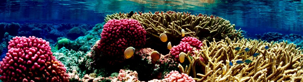
There is currently a strong El Niño event, for which there are significant impacts around Hawaii and the Pacific Islands, including extended drought conditions, enhanced risk of damaging tropical cyclones, increased risk of coral bleaching, and possible spread of vector borne disease and illness.
The El Niño–Southern Oscillation (ENSO) is a recurring climate pattern involving changes in the temperature of waters in the central and eastern tropical Pacific Ocean and the patterns of sea level pressure, lower- and upper-level winds, and tropical rainfall across the Pacific basin. This irregular oscillation between warm and cool patterns, referred to as the ENSO cycle, directly affects rainfall distribution in the tropics and can have a strong influence on weather across the Pacific basin.
The following El Niño fact sheetsfor Hawaii and the Pacific Islands were created by the NOAA Hawaii and Pacific Islands ENSO Tiger Team, and are immediately available for download and distribution to policy makers, natural resource managers, community members, and interested stakeholders. For more information, please contact the Pacific Region Climate Officer of the Pacific ENSO Applications Climate Center (peac@noaa.gov).
2015 El Niño and Pacific Islands Fact Sheets
American Samoa
Guam and the CNMI
East FSM (Pohnpei and Kosrae)
West FSM (Yap and Chuuk)
Hawaii
Palau
RMI
Cover image: Sea surface temperature anomaly on 11/12/2015, visualization from http://earth.nullschool.net/ by Cameron Beccario, Real Time Global SST from MMAB / EMC / NCEP
Resilient and sustainable Pacific Island communities using climate information to manage risks and support practical decision-making about climate variability and change.

Pacific Island Fact Sheets
Leave a Comment
Posted on November 12, 2015 by pacrisa
Pacific Island Fact Sheets Released on El Niño and Sectoral Impacts
There is currently a strong El Niño event, for which there are significant impacts around Hawaii and the Pacific Islands, including extended drought conditions, enhanced risk of damaging tropical cyclones, increased risk of coral bleaching, and possible spread of vector borne disease and illness.
The evolution and duration, strength and impacts of individual El Niño events can vary, in some cases greatly. This makes constant monitoring and awareness extremely important for decision makers across multiple sectors. Impacts also vary by island, and these seven fact sheets outline different physical impacts on different sectors and projected trends in relevant climate variables for Hawaii, American Sāmoa, Guam and the Commonwealth of the Northern Marianas Islands, the eastern and western Federated States of Micronesia, the Republic of Palau, and the Republic of the Marshall Islands.
The El Niño–Southern Oscillation (ENSO) is a recurring climate pattern involving changes in the temperature of waters in the central and eastern tropical Pacific Ocean and the patterns of sea level pressure, lower- and upper-level winds, and tropical rainfall across the Pacific basin. This irregular oscillation between warm and cool patterns, referred to as the ENSO cycle, directly affects rainfall distribution in the tropics and can have a strong influence on weather across the Pacific basin.
The following El Niño fact sheetsfor Hawaii and the Pacific Islands were created by the NOAA Hawaii and Pacific Islands ENSO Tiger Team, and are immediately available for download and distribution to policy makers, natural resource managers, community members, and interested stakeholders. For more information, please contact the Pacific Region Climate Officer of the Pacific ENSO Applications Climate Center (peac@noaa.gov).
2015 El Niño and Pacific Islands Fact Sheets
Cover image: Sea surface temperature anomaly on 11/12/2015, visualization from http://earth.nullschool.net/ by Cameron Beccario, Real Time Global SST from MMAB / EMC / NCEP
Related
Category: General Tags: drought, El Niño, ENSO, Outreach
Our Vision
Resilient and sustainable Pacific Island communities using climate information to manage risks and support practical decision-making about climate variability and change.
Tag Cloud
Follow Pacific RISA
Subscribe to our mailing list
Archives
Links