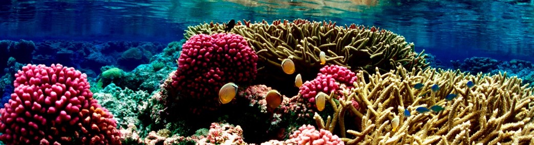
Coastal, social and ecological vulnerability – lessons from the Galapagos Islands, Ecuador
During her postdoctoral fellowship with the Center for Galapagos Studies at the University of North Carolina, Pacific RISA Fellow Dr. Laura Brewington conducted field research in the Galapagos Islands of Ecuador, using a methodology that is relevant to Hawaii and other Pacific islands that are vulnerable to climate change and other factors. Mixed methods were used to assess social and ecological vulnerability of coastal environments, and form the baseline for future change detection.
The oil spill caused by the grounding of the tanker the Jessica in January 2001 led to calls for the creation of a management response network in Galapagos for preparation for coastal hazards. One decade later, the two tsunamis altered the configuration of shorelines areas that are home to burgeoning human populations and nesting grounds for endemic species. To anticipate the scale and impacts of climate change, natural hazards, and human use, novel and transferable vulnerability assessment approaches are required – especially in diverse and fragile island settings. Coastal areas are critical transition zones between land and the open ocean, providing essential ecosystem services like shoreline protection, nutrient cycling, fisheries resources, habitat and food, and regulation of nutrients, water, and organisms.

The coastal village of Puerto Villamil, Isabela Island (population 2,500)
Our pilot project in 2013 created a database of linked spatial, social, and environmental indicators of vulnerability for the Galapagos coastline. First we assigned values from 1 (very low) to 5 (very high) to a set of eight vulnerability criteria for 13 focal areas in the archipelago. We chose four local factors (land use, land cover, remoteness, human use intensity) and four external factors (orientation, connectivity, topography, and geomorphology). Criteria were evaluated using a combination of qualitative and quantitative measures, including shoreline surveys, three-dimensional terrain scanning, land cover interpretation using aerial photography, and sediment sampling. To address gaps in the available data and to obtain historical information on these criteria we solicited information from key informants in marine science, conservation, and tourism in Galapagos.
Vulnerability criteria for each study area were entered into a GIS to develop virtual beach models that can be compared among sites for common characteristics. In the four sites where urban development is present we used a set of indicators from census and survey data to assign levels of social and economic vulnerability at the block level, and with satellite imagery classified these areas into meaningful categories that may be associated with vulnerability – such as land cover types, urban development indices, and the presence/absence of invasive species. Moving forward we expect to combine established characteristics of each type of coastal habitat and associated vulnerability with satellite imagery to create a comprehensive vulnerability profile of all beaches in the Galapagos, for use in marine and terrestrial spatial planning and mitigation of environmental hazards. Identifying focal areas for monitoring and management activities is an essential component of the Pacific RISA program, supporting informed decision-making about climate change and other future hazards.

Puerto Villamil from above, using Worldview-2 satellite imagery from 2010 and the census blocks overlaid to indicate regions that exhibit high social and ecological vulnerability characteristics in yellow.
Related

Lessons from the Galapagos
Leave a Comment
Posted on October 9, 2013 by pacrisa
Coastal, social and ecological vulnerability – lessons from the Galapagos Islands, Ecuador
During her postdoctoral fellowship with the Center for Galapagos Studies at the University of North Carolina, Pacific RISA Fellow Dr. Laura Brewington conducted field research in the Galapagos Islands of Ecuador, using a methodology that is relevant to Hawaii and other Pacific islands that are vulnerable to climate change and other factors. Mixed methods were used to assess social and ecological vulnerability of coastal environments, and form the baseline for future change detection.
The oil spill caused by the grounding of the tanker the Jessica in January 2001 led to calls for the creation of a management response network in Galapagos for preparation for coastal hazards. One decade later, the two tsunamis altered the configuration of shorelines areas that are home to burgeoning human populations and nesting grounds for endemic species. To anticipate the scale and impacts of climate change, natural hazards, and human use, novel and transferable vulnerability assessment approaches are required – especially in diverse and fragile island settings. Coastal areas are critical transition zones between land and the open ocean, providing essential ecosystem services like shoreline protection, nutrient cycling, fisheries resources, habitat and food, and regulation of nutrients, water, and organisms.
The coastal village of Puerto Villamil, Isabela Island (population 2,500)
Our pilot project in 2013 created a database of linked spatial, social, and environmental indicators of vulnerability for the Galapagos coastline. First we assigned values from 1 (very low) to 5 (very high) to a set of eight vulnerability criteria for 13 focal areas in the archipelago. We chose four local factors (land use, land cover, remoteness, human use intensity) and four external factors (orientation, connectivity, topography, and geomorphology). Criteria were evaluated using a combination of qualitative and quantitative measures, including shoreline surveys, three-dimensional terrain scanning, land cover interpretation using aerial photography, and sediment sampling. To address gaps in the available data and to obtain historical information on these criteria we solicited information from key informants in marine science, conservation, and tourism in Galapagos.
Vulnerability criteria for each study area were entered into a GIS to develop virtual beach models that can be compared among sites for common characteristics. In the four sites where urban development is present we used a set of indicators from census and survey data to assign levels of social and economic vulnerability at the block level, and with satellite imagery classified these areas into meaningful categories that may be associated with vulnerability – such as land cover types, urban development indices, and the presence/absence of invasive species. Moving forward we expect to combine established characteristics of each type of coastal habitat and associated vulnerability with satellite imagery to create a comprehensive vulnerability profile of all beaches in the Galapagos, for use in marine and terrestrial spatial planning and mitigation of environmental hazards. Identifying focal areas for monitoring and management activities is an essential component of the Pacific RISA program, supporting informed decision-making about climate change and other future hazards.
Puerto Villamil from above, using Worldview-2 satellite imagery from 2010 and the census blocks overlaid to indicate regions that exhibit high social and ecological vulnerability characteristics in yellow.
Related
Category: General, News
Our Vision
Resilient and sustainable Pacific Island communities using climate information to manage risks and support practical decision-making about climate variability and change.
Tag Cloud
Follow Pacific RISA
Subscribe to our mailing list
Archives
Links